Coming soonJune 2026
Lake Peyre - Aravis Mountains
Col de la Colombière, Haute-Savoie
About the project
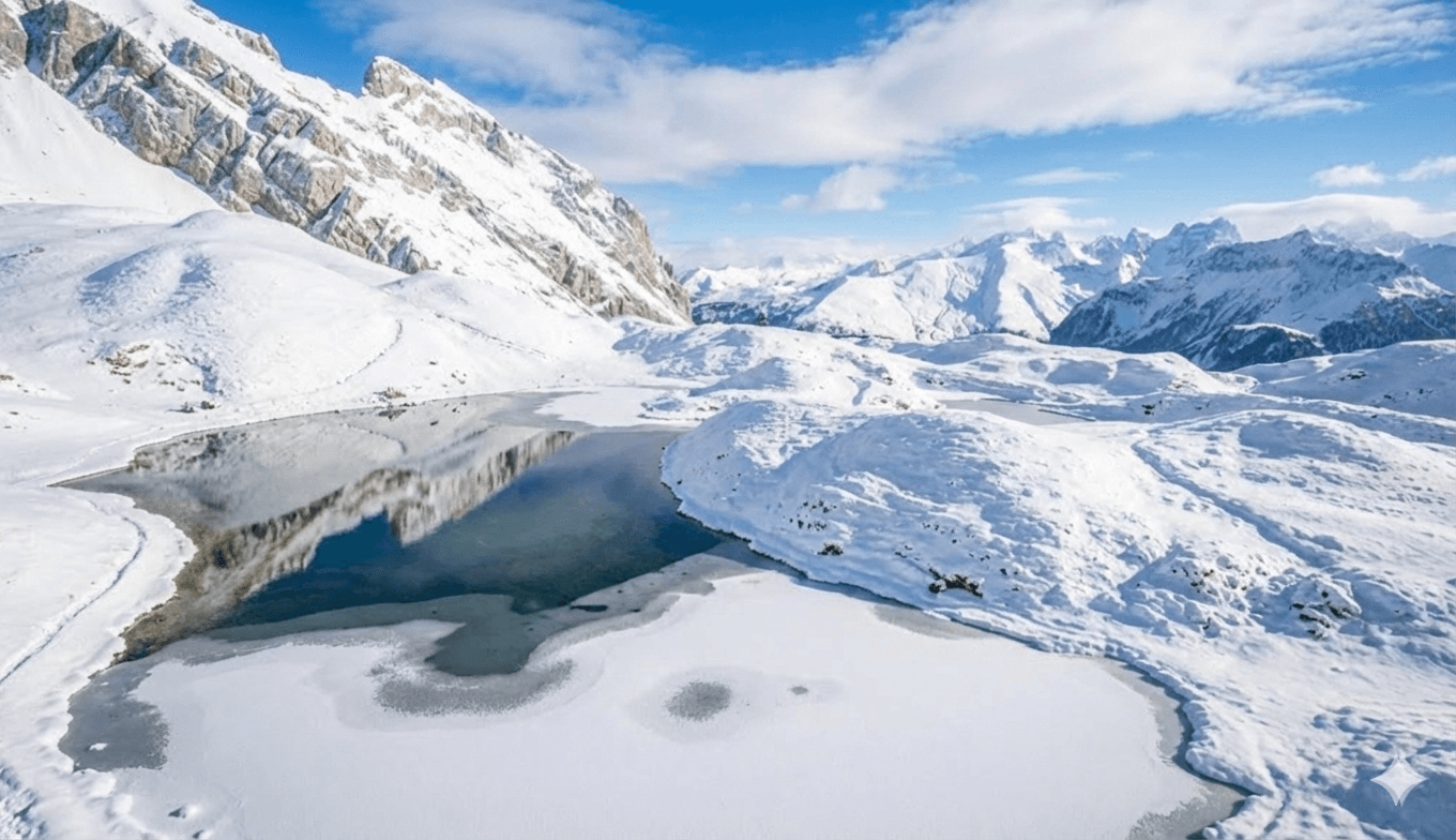
Photographic hike to Lake Peyre, protected natural site offering exceptional views of Mont-Blanc massif.
Exploring Lake Peyre, located at 2108 meters altitude in the Bornes-Aravis massif. Natura 2000 site renowned for its natural richness and panoramic Mont-Blanc views. Capturing lake reflections, alpine wildlife (ibex, marmots) and lights on this preserved but highly frequented site. A project raising awareness about preserving fragile natural spaces.
Access
From Col de la Colombière parking (1613m), follow the pastoral track indicating Chalet de la Colombière. At the chalet (1746m), turn left heading north towards Lake Peyre. The trail alternates between flat sections and climbs to the lake (2108m). Distance: about 6 km round trip, elevation gain: 500m, duration: 3h30. Moderately difficult hike, very busy (up to 600 hikers/day in high season).
Location
Lieux
Points de vue
Chargement de la carte...
Photography Viewpoints
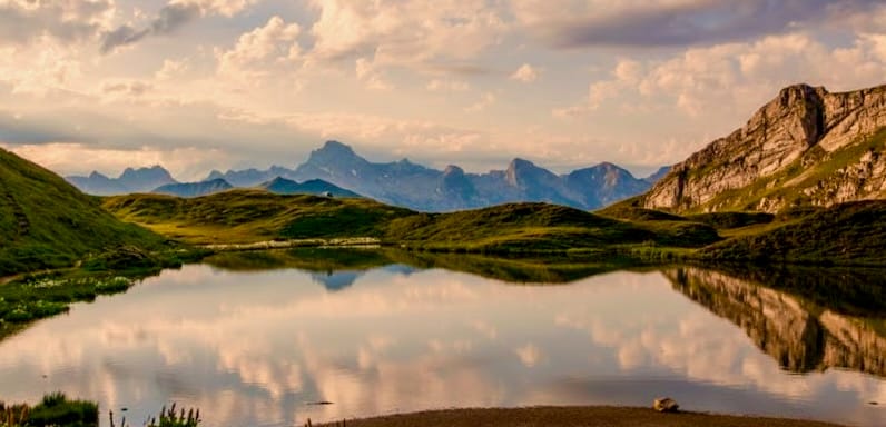
Rive nord du lac
EasySunrise
Accessible viewpoint offering a unique perspective on the lake's crystal-clear waters with Aravis peaks in the background. Ideal for capturing morning reflections and golden light settling on the ridges. Prime spot to observe ibex and with luck, catch sight of the bearded vulture soaring over the area at sunrise.
📍 46.00181, 6.46697
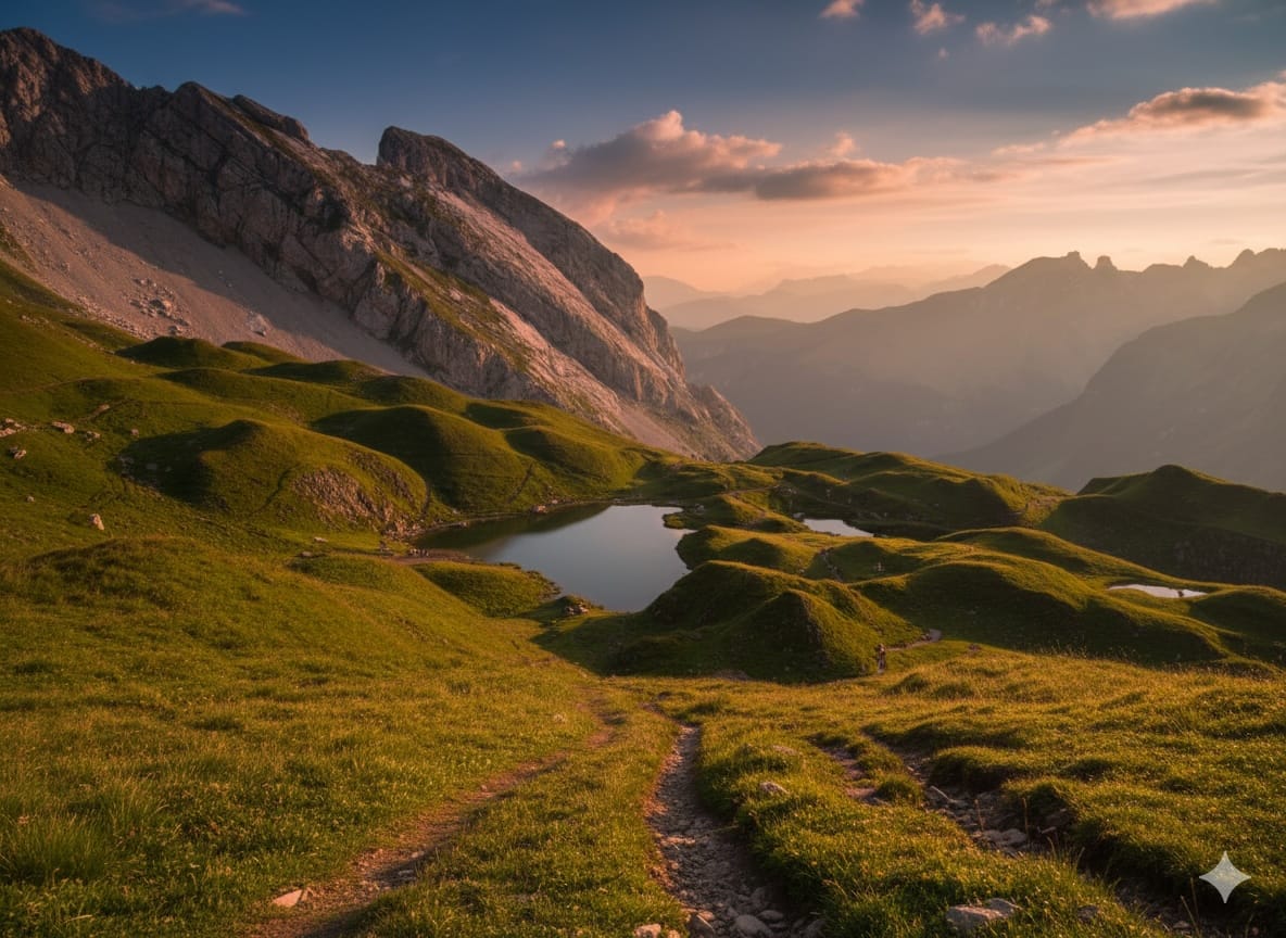
Col de Belafrasse
MediumSunset
Natural belvedere overlooking Lake Peyre with 360° panoramic views of Mont-Blanc massif and Aravis. Strategic position for photographing sunsets setting the peaks ablaze. Beware of wind at altitude, bring a stable tripod.
📍 46.00091, 6.46248
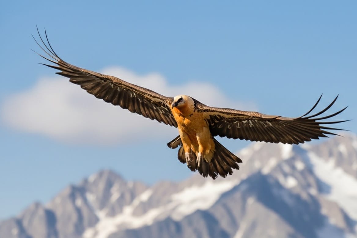
Gypaète barbu
MediumMorning
Prime observation point for photographing the majestic bearded vulture, one of Europe's largest raptors. This magnificent bird with nearly 3-meter wingspan regularly soars over the rocky ridges above the lake in the morning. Equip yourself with a telephoto lens (400-600mm) and patience to capture this aerial giant in its natural habitat. Best observation chances are early morning when thermal currents form.
📍 46.00200, 6.46800
Best season
Best period: June to September. Ideal in July-August but heavy crowds. Favor sunrise and sunset to avoid crowds and capture the best light. Beware of afternoon thunderstorms in summer. Protected Natura 2000 site: bivouac tolerated only from sunset to sunrise, swimming prohibited, ground fires banned (stoves allowed), camping and drones forbidden.
Recommended equipment
Camera + wide-angle lens for landscapes and reflections, telephoto for wildlife (visible ibex, 200-400mm), tripod, ND and polarizing filters, spare batteries, waterproof camera bag. Hiking: mountain boots, poles, rain gear, water and food, IGN map 3430ET La Clusaz Grand-Bornand. Respect protected site regulations.
Tags
bornes-aravisalpeslachaute-savoiecolombière
Follow the Adventure
While waiting for these new projects, discover my current collection of photographs available for sale.
Discover the Gallery